![[louispage]](louis2a.gif)
Constructing stuff with WED and the Overlay Editor
Both are for different stuff. WED is used to create runways, taxiways, platforms, visual alignment systems. It also creates light beacons, which become at the same time your tower viewpoints. You can also create a manual tower viewpoint at another location instead of the light beacon. Now, the light beacon can be placed into any position, but its orientation cannot be changed.
The Overlay Editor on the other hand can also place light beacons and the fun part is that you can change their orientation as well. Suppose you have a building which acts as airport tower. Now you can add a light beacon which integrates with the tower building and align both so that it looks "nice".
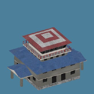
Here's an example: we take the mil beacon from the Airport directory in Overlay Editor:
At the same location we place a stone tower from the Xopenscenery directory:
After proper alignment and rotation of the two, you'll get this:
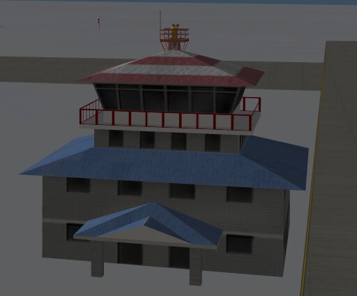
In the Overlay Editor it looks weird, but:
The construction of the building hides the underlying steelwork of the beacon in XPlane.... Since the light sits on the top of the roof, it is still visible, the steelwork is no longer of any importance. Go into XPlane freeze-mode, go into a slowly flying condtion and proceed towards the tower/beacon. Find out what the exact altitude of the lights is, go into WED and place a towerviewpoint at that exact location with the right altitude, which in this case is 56 feet.
If you don't place a tower-viewpoint in WED, the tower-viewpoint will be from the beacon. If there is no beacon, it will be on the centerline of your runway in the middle, or at the crossing point of two runways at ground level. Since in this case we placed the beacon in the Overlay Editor, the tower viewpoint will be set to the runway crossing. Therefore you need to set a viewpoint in WED.
There are also tower-constructions available with "see-thru-windows". Find out the "inside altitude" and adjust your tower-viewpoint altitude in WED, and next your tower-view is literally from the inside of the tower!
With the Overlay Editor you can add 3-d buildings, hangars, rotating radar installations, trees, animals, ships, static aircraft to your field. Install the Xopenscenery bundle and you have tons to choose from.
And finally, in XPlane itself you add ILS-es, VOR's and NDB's. Give them a proper range, like usually a LOC has a max range of something like 10-25 nm, the GS has a slightly lower range. If your latitude is way up or down, say over 65 degs North or South, extend the ranges to have a usable system.
A LOC always sits beyond the far end of the runway on the centerline, a GS is placed to the left or right of the runway at the tyre-markings on the runway. GS angle usually is 3 degrees, but may vary. This is also the location to place VASI or PAPI visual alignment systems in WED. Be sure to adjust the alignment to the runway heading, which means that if your system is for a landing on runway 27, the alignment should be 90 degrees! LOC alignment for the same runway should be 270...
Perhaps you've noticed that a lot of airports are just floating in the water. Go to Svalbard Longyear and you'll find out. You can add a polygon over the area in Overlay Editor, an icy one or whatever you choose. It means that when you get off the runway you won't hit water. The same goes for Antarctica. Only near Palmer Station they built a decent landmass (Anvers Island), but unfortunately the runway floats in the icy sea. Put a polar ice polygon under it and let it run to where the landmass begins at 64 West.
At 64.00W (where the light blue starts) begins the landmass in XPlane. I lenghtened the existing runway 01-19 a bit, added ILS, a VOR, shifted the NDB to the end of the landmass at 64.00W on top of the ridge, around 1178ft altitude and on the extended centerline of the runway, created a bigger runway 10-28 also with ILS and a platform with a tower and a few static aircraft. The runway surfaces are now concrete.
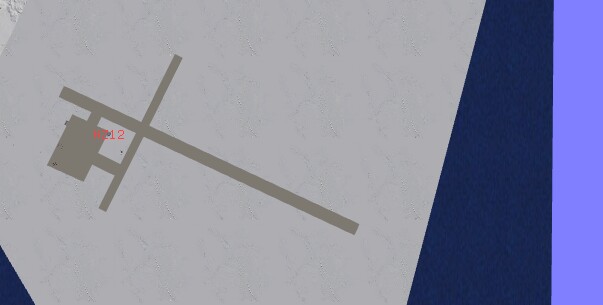
This gives you an impression of how NZ12/Palmer Station looks nowadays.
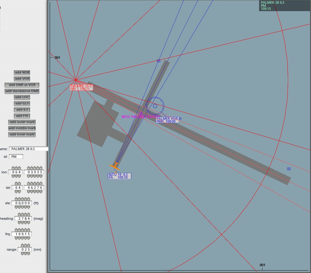
Map view in edit mode, so you know what to fill in...
Officially, ILS-es always work on 108.10, 108.15, 108.30, 108.35, 108.50, 108.55, 108.70, 108.75, 108.90 or 108.95. You can also operate them on the "same" frequencies in 109, 110 or 111 MHz. Officially the GS transmitters work on different frequencies in another band, but in XPlane you operate them on the same frequencies as the LOC transmitters.
The GS for RWY19 has an angle of 4 degrees. 3 degrees will just give you a clearance of 3 feet at the ridge edge, which is too dangerous. On a glideslope angle of 4 degrees you'll pass the ridge edge at 200 ft height. Note that the PAPI or VASI system for the same runway should be set to 4 degrees also! The highest mountains in the area are 7331, 6450 and 6222 ft high, making it an interesting part of the world to fly around.
Working around some troubles when you're editing in XPlane: installing VOR-DME. You can simply install a VOR giving it a name like "WHATEVER", then the ID, usually a 3 letter code. Don't mess with the heading (actually the local magnetic variation), XPlane will do that for you. The frequency can be anything between 108.00 and 117.95 using a 0.05 spacing (except for the ones which are reserved for ILS-systems, see above). A frequency of 112.125 will not work. Set an appropriate range, anything between 25 and 300nm will do. Now, adding DME to this VOR can be a hassle. The best is to copy the whole line in earth_nav.dat to the section where DME's are stored. A VOR starts with code 3. Sorting order here is always on the NAME, so BELCHER sits before BELEM and so on. A DME must sit in exactly the same position, so copy the relevant VOR-entry further on in the section which starts with 12, for DME's. Change the 3 into 12, and after the VOR-DME add DME. I'll give an example from my dat file with the Palmer VOR entries:
3 -64.77328491 -64.05058289 -0 10800 300 16.570 PMR PALMER VOR-DME
12 -64.77328491 -64.05058289 -0 10800 300 0.000 PMR PALMER VOR-DME DME
The bold part is the sorting name, which runs alphabetically. This goes for NDB's, VOR's, TACAN's and DME's. ILS-es, Glideslopes and Marker Beacons sort on their ICAO code for the airport and the lowest runway number comes first. If you have 3 parallel runways 35, 35C is first, 35L is next and 35R is last. Another thing is: the list prefers CAPITALIZED names. If you call a VOR Aalborg, it will be listed under AZZYYZZYR. If you'd call it aalborg, it might sort under ZULULAND. Keep an eye on that!
You see, the only real difference is the magnetic variation figure which is not relevant here, and the starting number which identifies your system. You can do the same for a LOC or GS system, add another line in the DME section with either the position at the GS transmitter (reading is 0 at touchdown point) or at the LOC position (reading is 0 on the LOC).
Another weird problem is that whenever you have edited the file while in XPlane, so using the map in edit mode, the program stores the navaids of the USS Laminar for some strange reason. At least, when this vessel is around, which is usually the case in areas with seas or lakes. Next time you fly around in the area, fat chances that the program crashes at some point telling you "can't find an object for a navaid". Of course not, the earth_nav.dat file says there's a USS Laminar VOR at some place and of course the USS Laminar actually is somewhere else. What can you do about that? After quitting XPlane, it asks "save the navaid file?". Of course you do that, then the program terminates and then load "earth_nav.dat" (which sits in /resources/default data/ into a text-editor, search for "laminar" entries and delete the lines. Usually there are two. After deleting the 2 lines, save the file again and all goes well. If you never noticed problems but frequently edited the file in XPlane, check its contents for "laminar". There may be dozens and someday you'll fly around somewhere, where you previously adjusted something in a navaid and you'll crash (the program) without knowing why! Earth_nav.dat shouldn't contain one single entry with the word "laminar" in it!!!
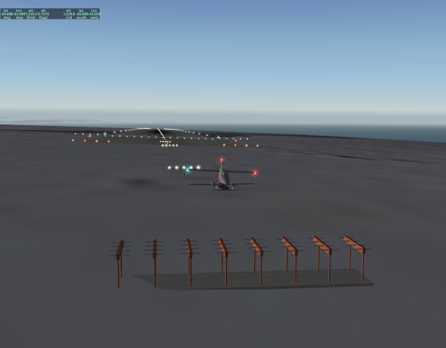
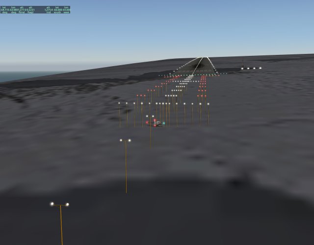
A few examples of how stuff should be placed:
The localizer transmitter, exactly on the extended centerline.
The other end of the runway, with Calvert-II alignment lights and to the right a PAPI near the GS transmitter. This actually is a test runway, the lower end sits at 1325 ft, the far end at 1532 ft. Catching the glideslope here means literally flying horizontally till touchdown! Don't use the "flatten runways" option here or the whole system no longer works!
Outer, middle and inner markers, LOC transmitters and such stuff can also be placed in the Overlay Editor, but they won't actually work. All radio stuff should be done in XPlane!
More stuff: I tried to put a radiomast on top of the highest mountain, in the Overlay Editor. Next start the whole landmass on the tile had gone. After I removed the mast, the land was back. I could place a runway on the top of the mountain (which has a "flat" top indeed), including a beacon and this works. Next I removed all the objects from Palmer and guess what: the airport lies indeed on the island, with the sea next to it and all the original objects from the scenery add-on are still there. So putting additional objects with Overlay Editor in here will ruin the land. After examination it appears that Palmer Station is built from env. files, including the terrain. As soon as you place an object in Overlay Editor on the land, it disappears and becomes water with the object floating too at zero feet. Hence the floating runway here.
Finally: XPlane (at least version 9) stops with landmasses beyond 75 degrees N and also something like 70 degrees S. So: no Antarctica. Also the northern parts of Nova Zembla, Canada, Greenland and perhaps the old USSR are missing. Recently I discovered a site, www.xpsrtm.com which has replacement files for the whole globe. So you can download the files for say S80 W080 and so on, unpack them, and put them into XPlanes Custom Scenery. They use .env files, which at least work in XPlane 9 too. The only thing is: the folder structure is ../resources/earth nav data/files, where earth nav data should be moved out of resources and resources itself can be deleted. So the structure could be Custom Scenery/Antarctica/Earth nav data/-90-080 and all the subfolders you have downloaded. Then you can fly at 20,000ft across Mount Vinson which is at least less boring than crossing the Southpole over water.
Page revised 23.01.2013